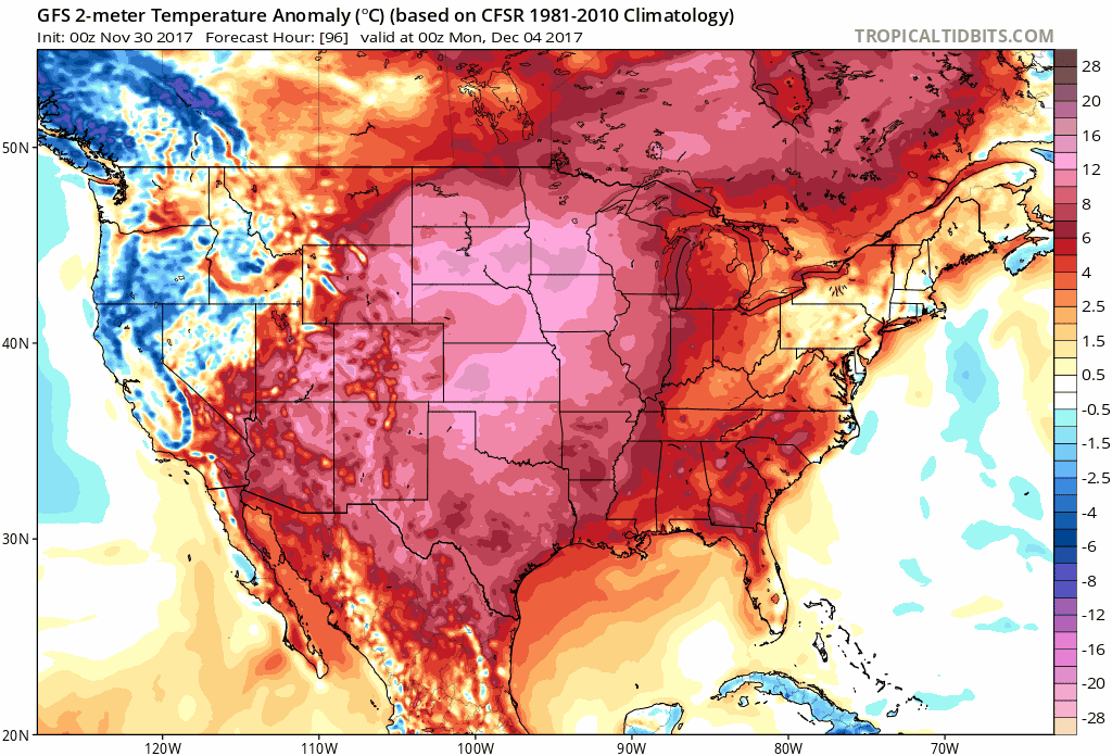
|
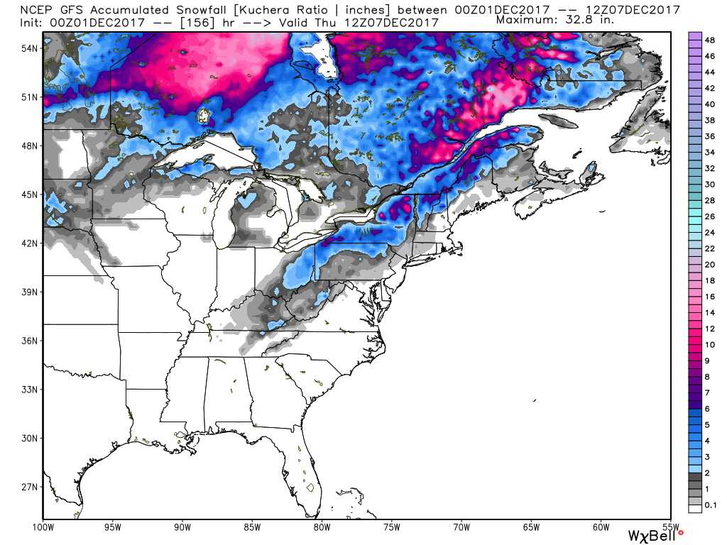
Hello everyone, forecaster Andre Brooks here with the latest on the southern winter storm. As you can see on the current radar, the snow is coming down, at some areas very heavy. Some areas are seeing rain mixed with snow, or even rain mixed with sleet. 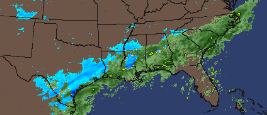 Image 1- A southern snowstorm in the making with some heavier bands, making the accumulations greater than an inch at times. The amount of snow that is in store the south according to our American Model (GFS Model) shows a good deal of snow coming for parts of the south throughout the morning and afternoon hours on today. 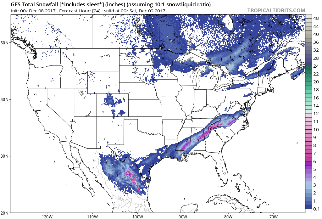 Image 2-00Z GFS Model Snowfall map through 00Z Saturday. We will keep you posted and you guys stay safe and have a blessed and wonderful day. -Andre
0 Comments
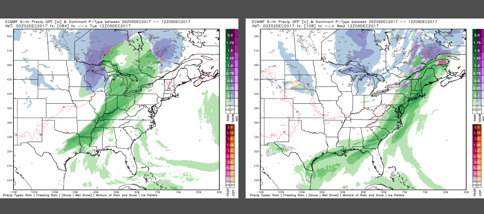
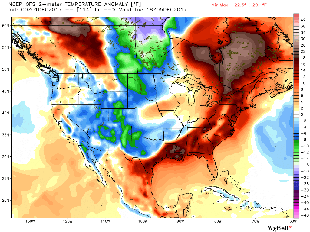
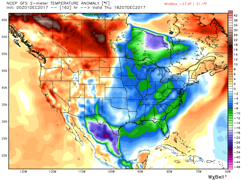
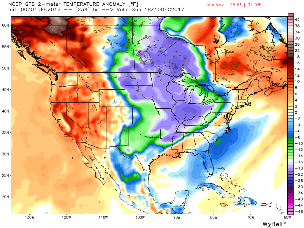
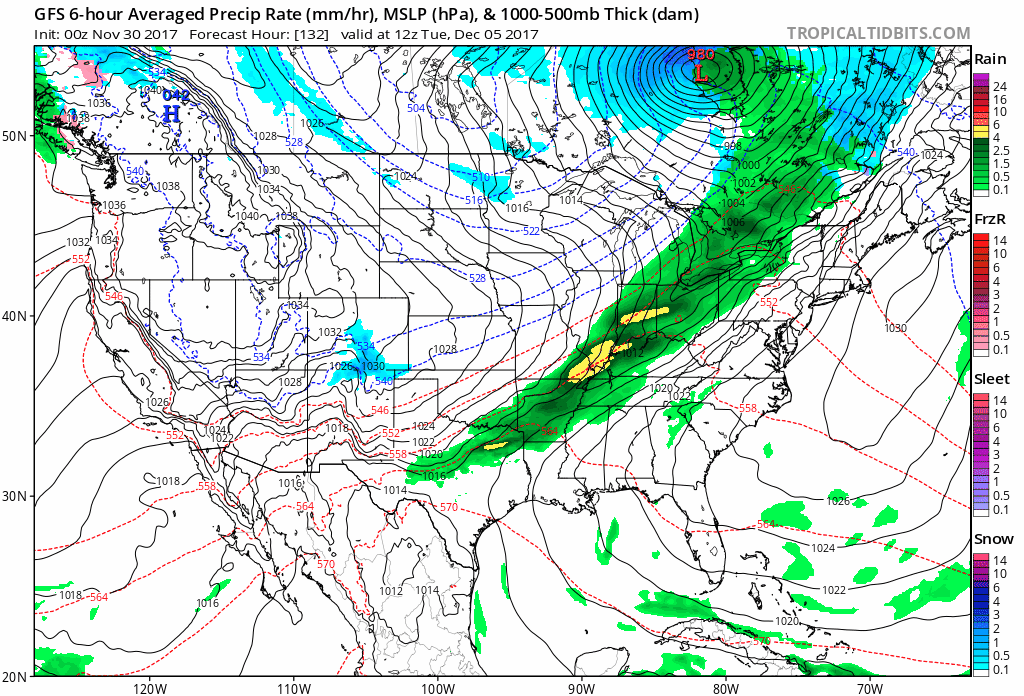
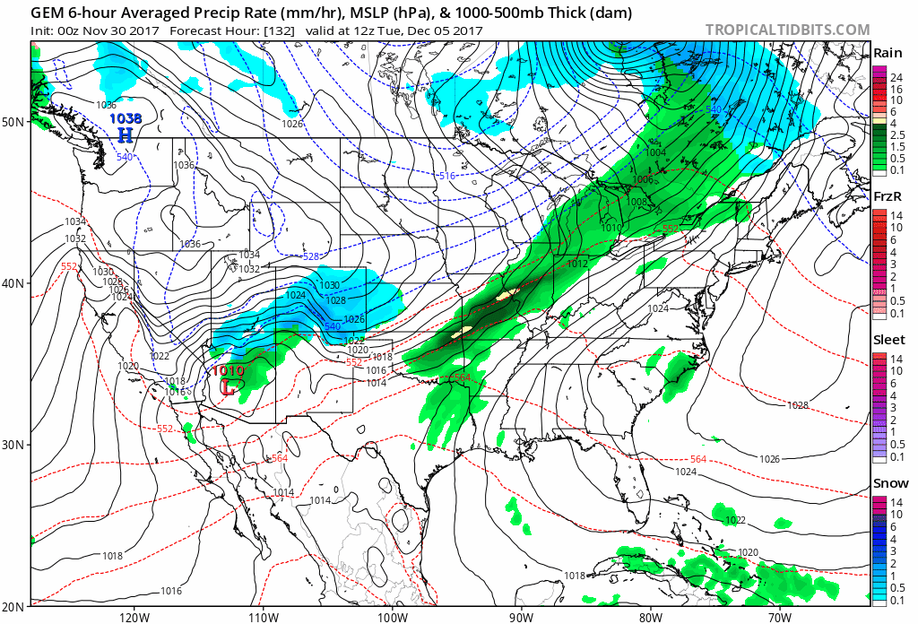
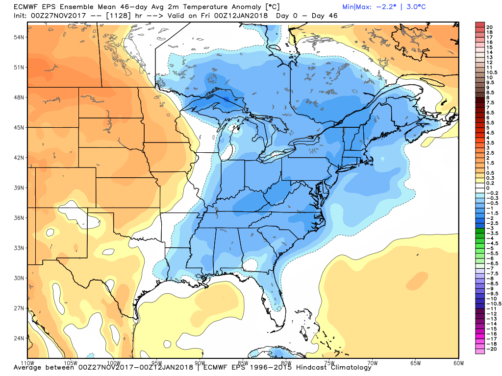
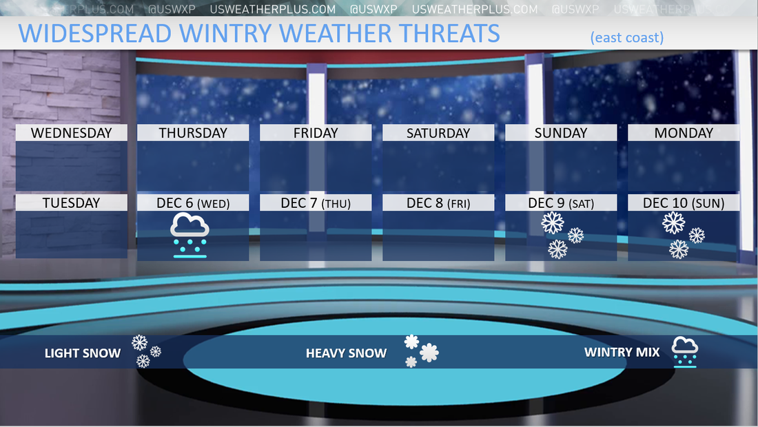
Good Wednesday to one and all. We are halfway through the work and school week. There are a couple wintry potentials showing up... the southern system and of course the clipper this weekend. We are finally in the transition period from warm temperatures to well below average temperatures, which has been well advertised for the last couple weeks. Let's hop right into things... There has been a lot of talk about the possible southern system late-week. While we don't expect anything significant, some areas could see their flakes and possible light accumulations. Of course that is unusual for the south, let-alone the first week of December. Here is an updated call on who has the greatest potential to see something... 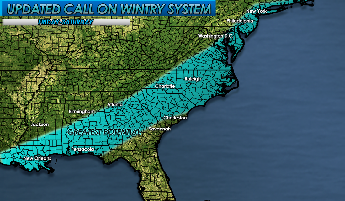 As stated in our previous update... "Now, before anyone criticizes us that we're hyping or that we are wrong, please note that this will not drop a lot of snow. Up to an inch is possible where it's much colder and in the higher elevations. No road problems expected right now, as most surfaces should be above freezing." Based off the latest trends, I think isolated areas will surpass an inch. We will try to dive into a little more specifics on tonight's update with possible accumulation numbers. That is what I will be working on today. The clipper system for the Ohio Valley this weekend is still showing up well on the models...  We will dive into that more on tomorrow's blog post. That could deliver a quick 1-2"+ for the Ohio Valley. Let's see if this trends any stronger as we get a bit closer.
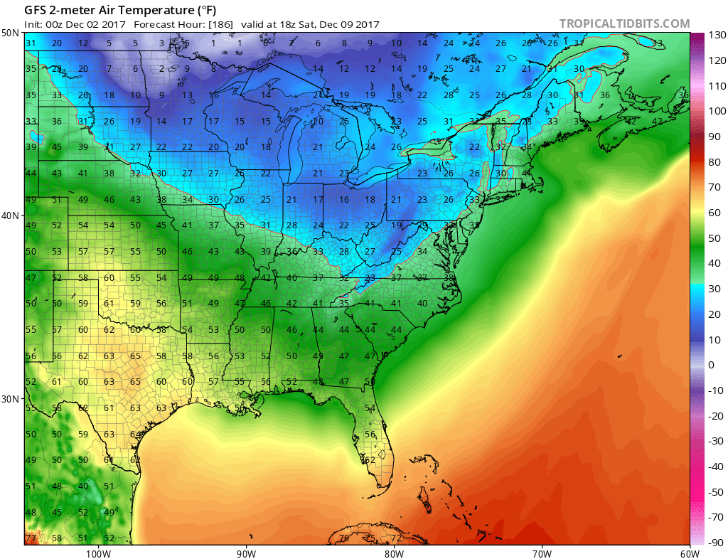
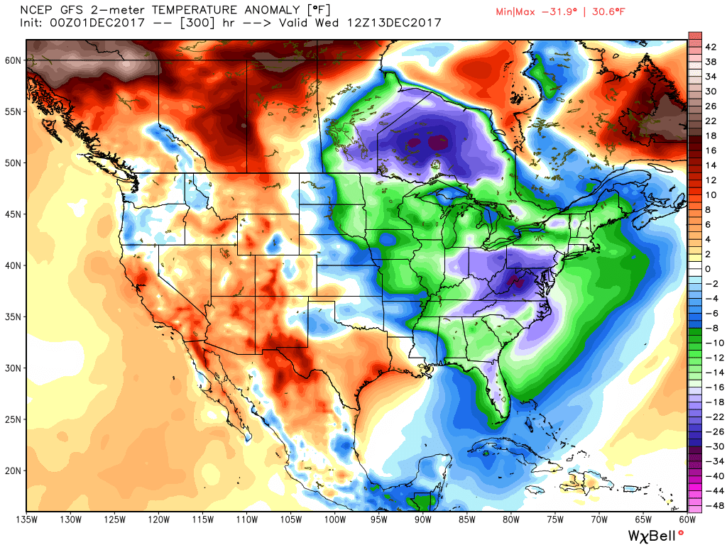
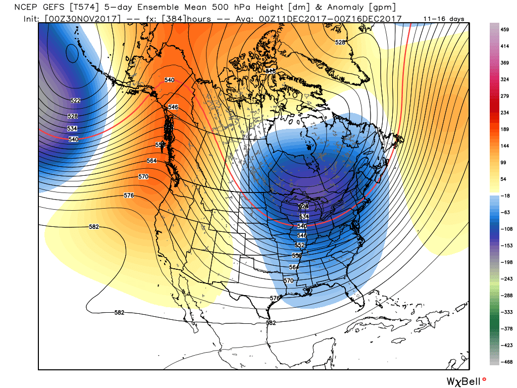
More clipper systems will be diving in from the NW next week that could be a bit more substantial. Obviously, the tracks of the clippers are not known at this time. The pattern doesn't support any 'big' snowstorms within the next 10 days due to the cold air being too strong, which squashes the systems south. Another update comes your way this evening! Have a great hump day and take care. - Braden Good Tuesday to everyone. If you watched the Bengals VS Steelers game last night, it was a crazy one... Coming from a Bengals fan, it was a devastating loss. It's time to move on and track the wintry pattern setting up in the very near future. You'll find that this update will be short in length because everything has been talked about in previous posts. In the short term, we have rain moving through from west to east that could lead into tomorrow. Gusty winds will also be a factor. Here is the latest short range model forecast through tomorrow... 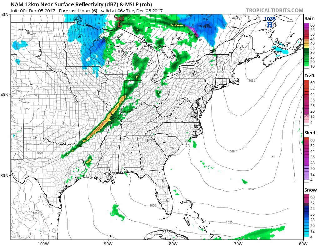 Things start to get interesting late Thursday as we see that southern system showing up on the models. Each model has wintry precip for pats of the SE and east coast but differ on timing and intensity. The NAM is very impressed with the potential. For fun, let's take a look at what it shows below... 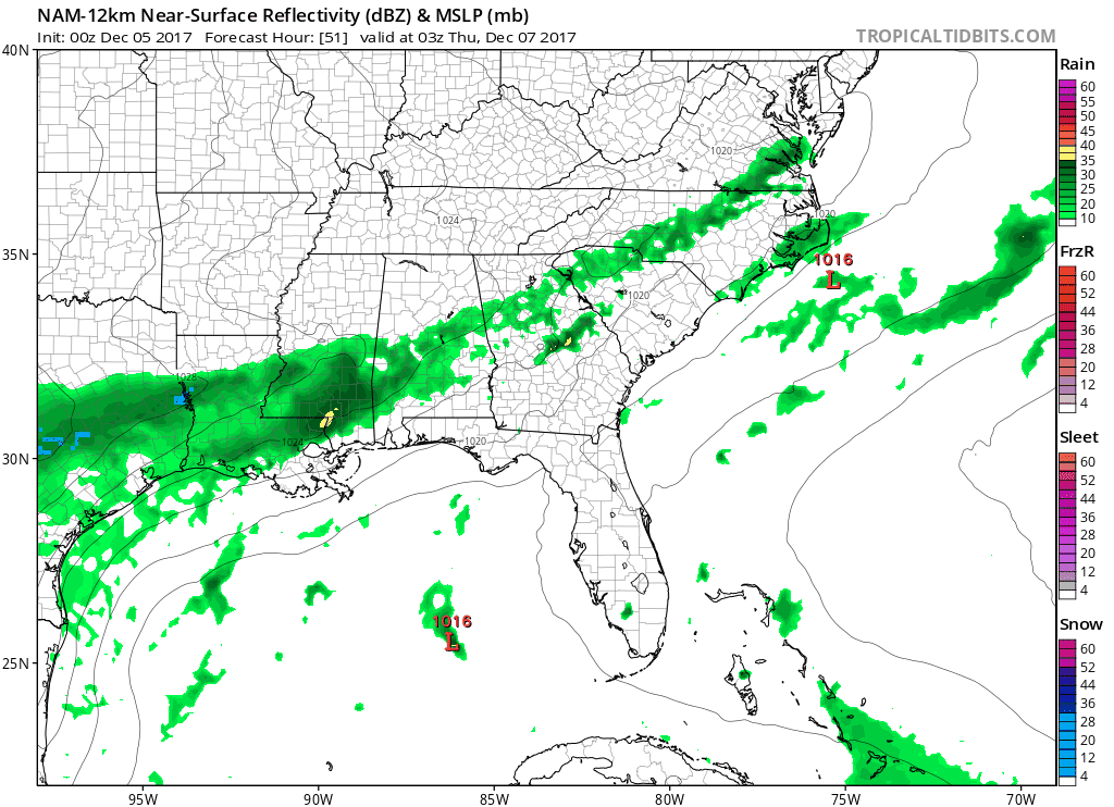 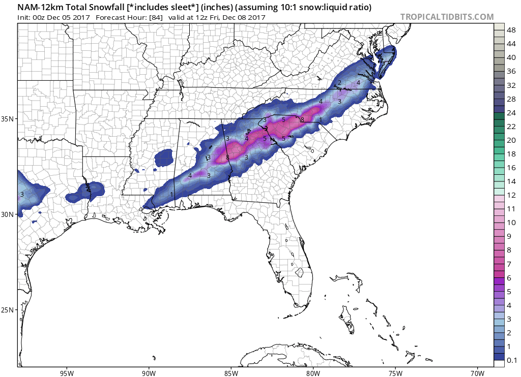 That is only through 84 hours. That scenario is pretty extreme and I definitely don't think snow totals would be that high. The NAM is known for spitting out high snow totals, especially in the longer range. The CMC is similar but brings it in slightly later than the NAM. Also, note the clipper passing through the Ohio Valley this weekend. I think the CMC is underplaying the Clipper. 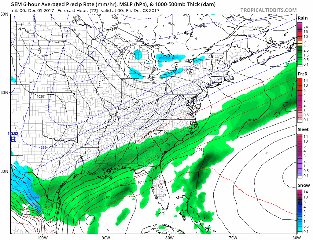 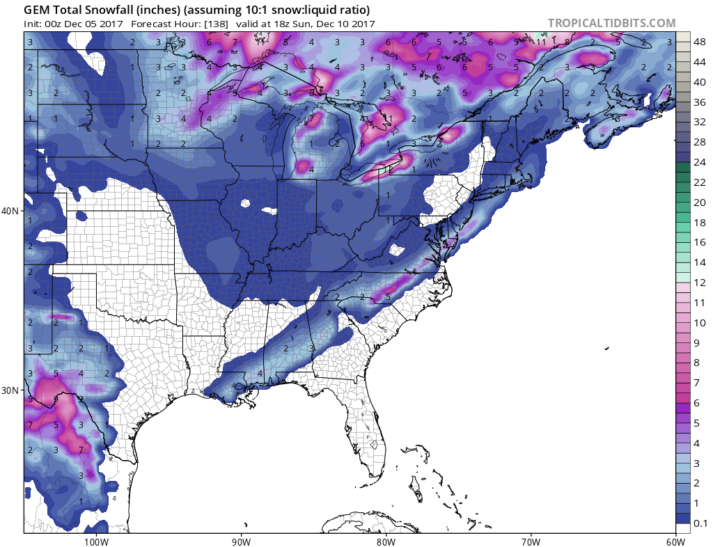 Verbatim,Look how far south the CMC has the light snow. NW Florida? Whaaat. Euro snowfall projections through the weekend. It's also showing the clipper in the Ohio Valley... 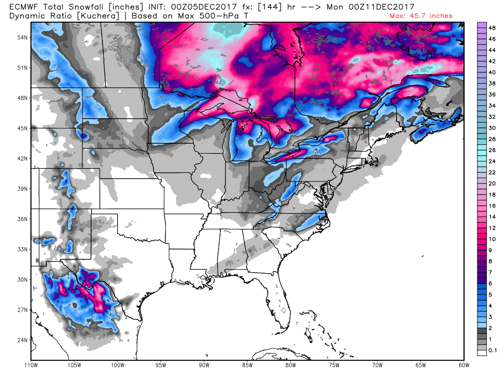 Finally, here is the GFS... 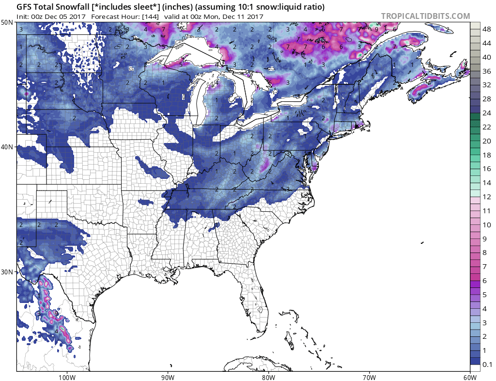 The GFS isn't nearly as impressed for the snow potential in the south as the other models. Note that it also shows the clipper in the Ohio Valley. I could see this above GFS solution having the right idea, but we shall see. I know I have thrown a lot of stuff your way, so let's summarize here... - Model projections show the possibility for a LIGHT wintry event in parts of the south and parts of the east coast. Timing looks to be around this Friday if this event occurs. I'm not completely sold on that scenario working out yet. Please understand that I said "light", so please don't overemphasize the potential. IF this event occurs, there looks to be some sleet mixed in. - Model projections have well advertised the Ohio Valley clipper this weekend. My confidence is pretty high for that event. Light accumulations are possible. - I share with you behind the scenes information that we look at to give you a heads up about potential systems. Also, here Is a graphic that was released on US Weather Plus for potential snow chances over the next 7 days.... MAY have to adjust it a bit farther south... 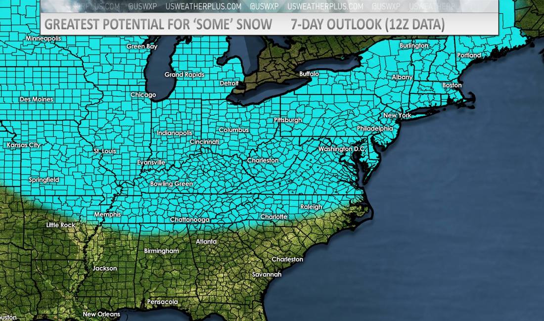 Let's watch for a couple more clippers to pass through early next week that could be a bit more substantial. However, like I said, we will take each system with a case by case basis.
Just to clarify... I didn't say there was going to be a snowstorm this week, however a possible light event for the south and Ohio Valley. Note the word possible. Don't get too excited yet, but the potential is there. Understand? Good. :) So much for this being a short post :). I will be out most of today, but I will update things this evening. We should start to get better agreement within the next couple days. Have a great Tuesday! - Braden Good Monday morning to one and all! I hope everyone had a fantastic weekend because we have some major changes coming later this week. This has been well advertised over the last week. Before we get into the weather segment, I wanted to throw a couple things out there... I've been quite surprised with the trolls that have commented on our posts over the last several days. We have several folks telling us our "forecast is wrong" or "my local news didn't say that." If you do not have anything nice or productive to say, then please don't say it at all. I would hate to turn off the commenting option. Critiquing us is one thing, being disrespectful is another thing. We put A LOT of time and effort into our page. BTW, for folks that rely on weather apps apps (such as AccuWeather/The Weather Channel,etc)... Please note that there is no human input in their forecasts, it's all computer generated... Just some food for thought. Let's talk some weather.... Over the weekend, my thoughts haven't changed. Here's a bit of a recap of what to expect in the upcoming weeks...
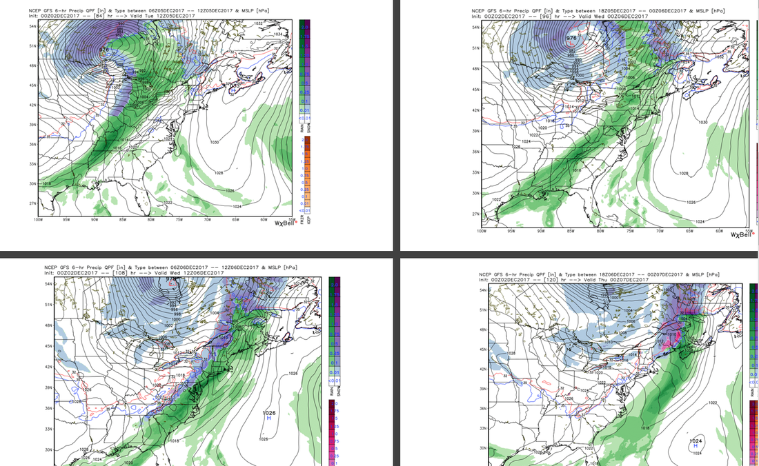
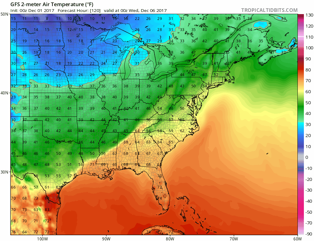
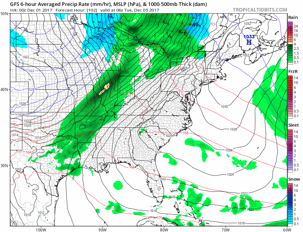
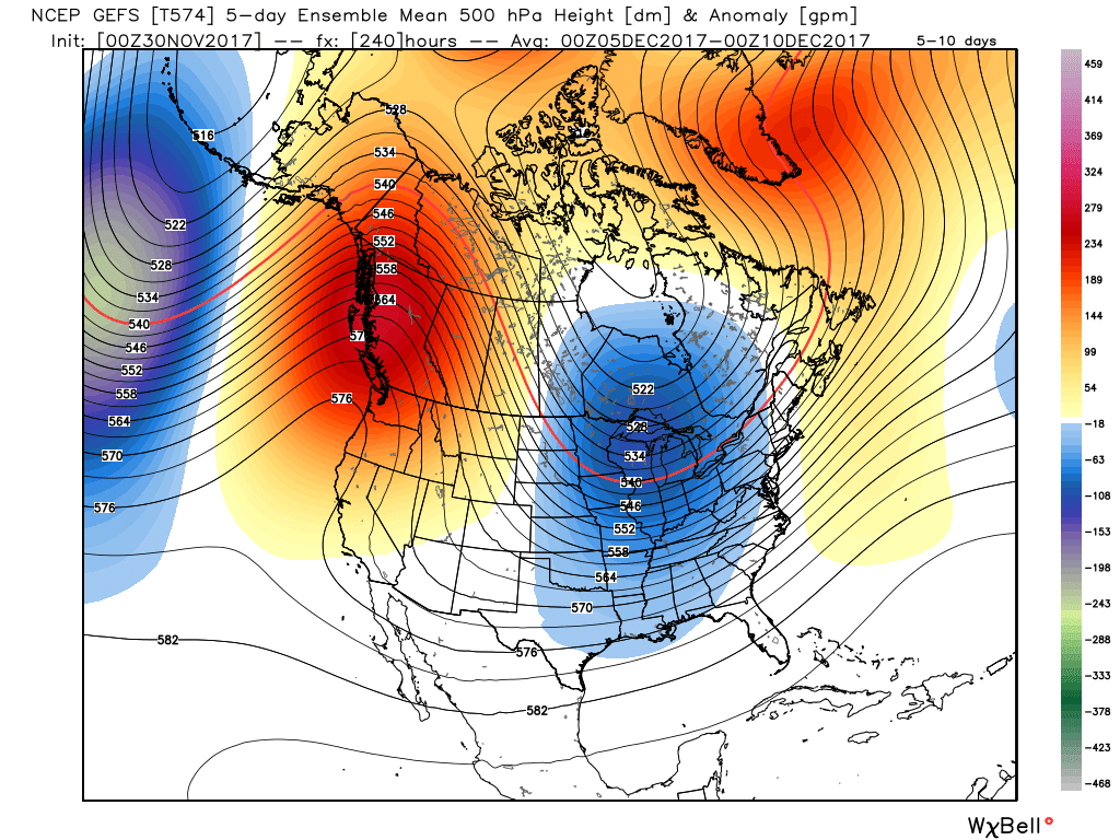
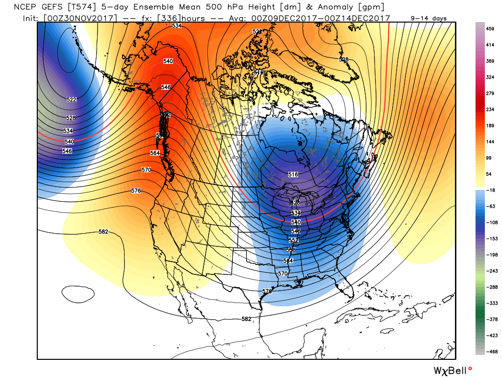
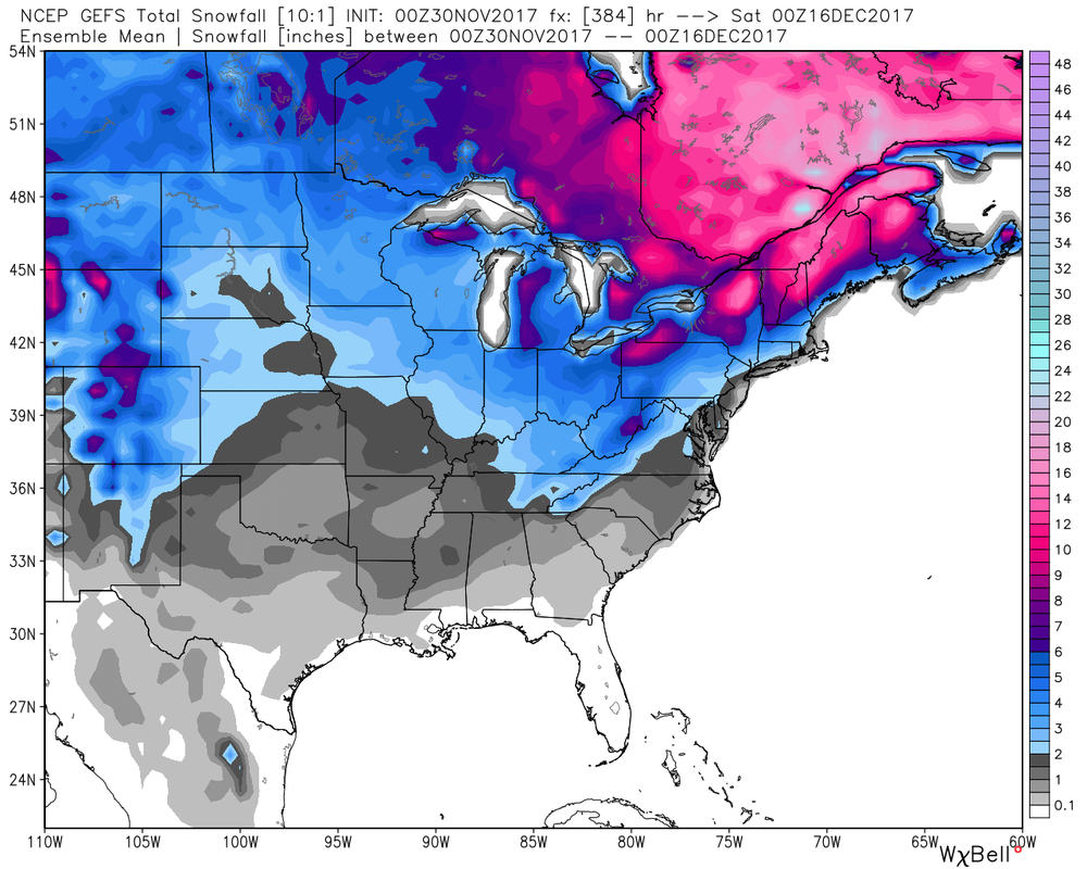
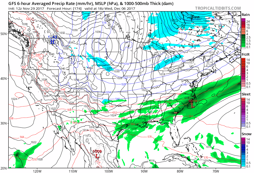
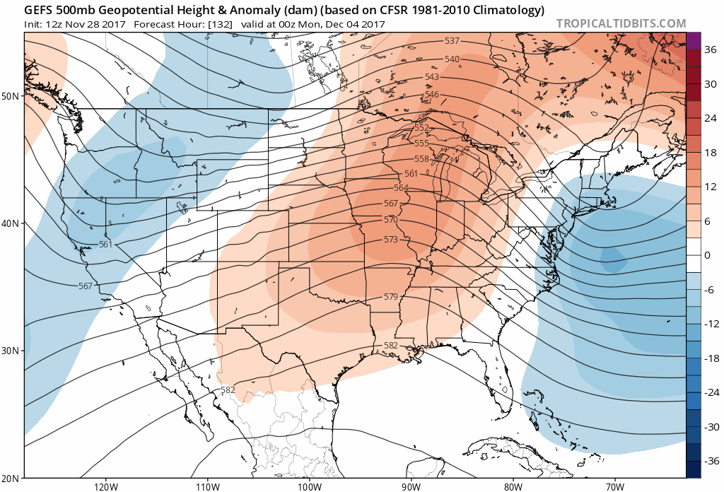
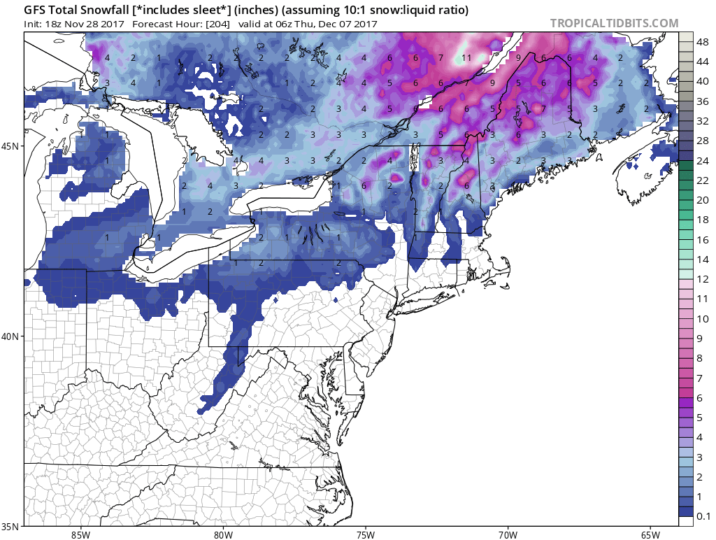
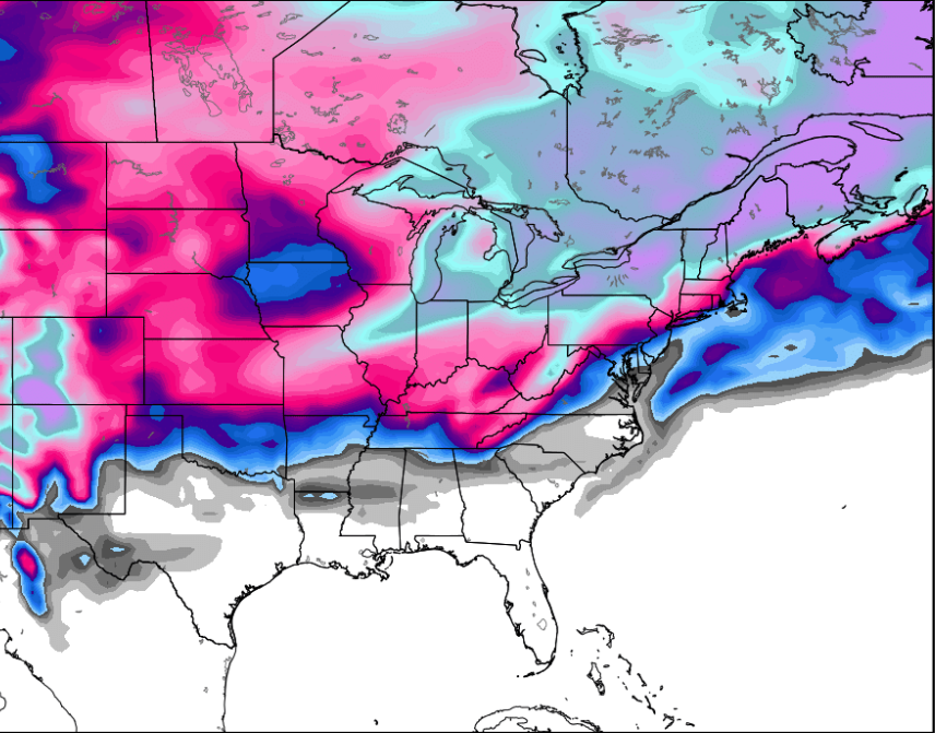
As we talked about last week, I didn't like the chances for anything major in terms of wintry weather mid-week as the front passes. Models indicate this will be a rain event with some back-edge snow in the New England area. 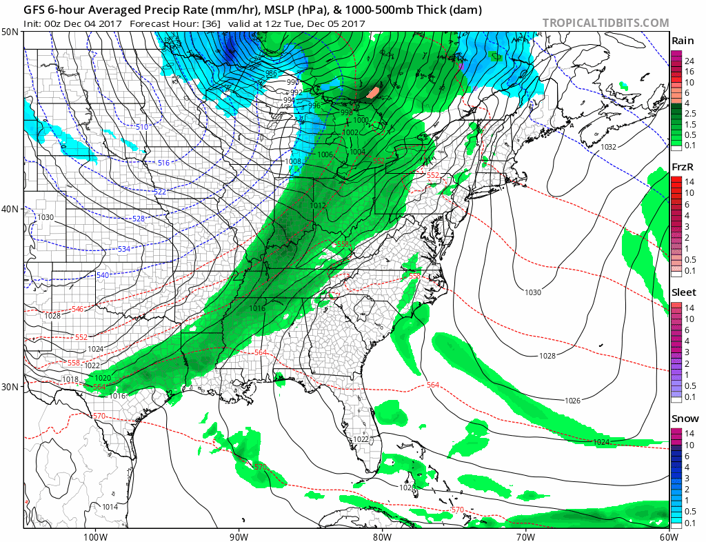 Also, note the snow showers off of the NW wind Wednesday. Our first real interest for a wintry setup will be later this week. The latest guidance wants to bring a pretty impressive clipper across the Ohio Valley and some type of system going up to east coast around the same time. Watch how the GFS handles it... 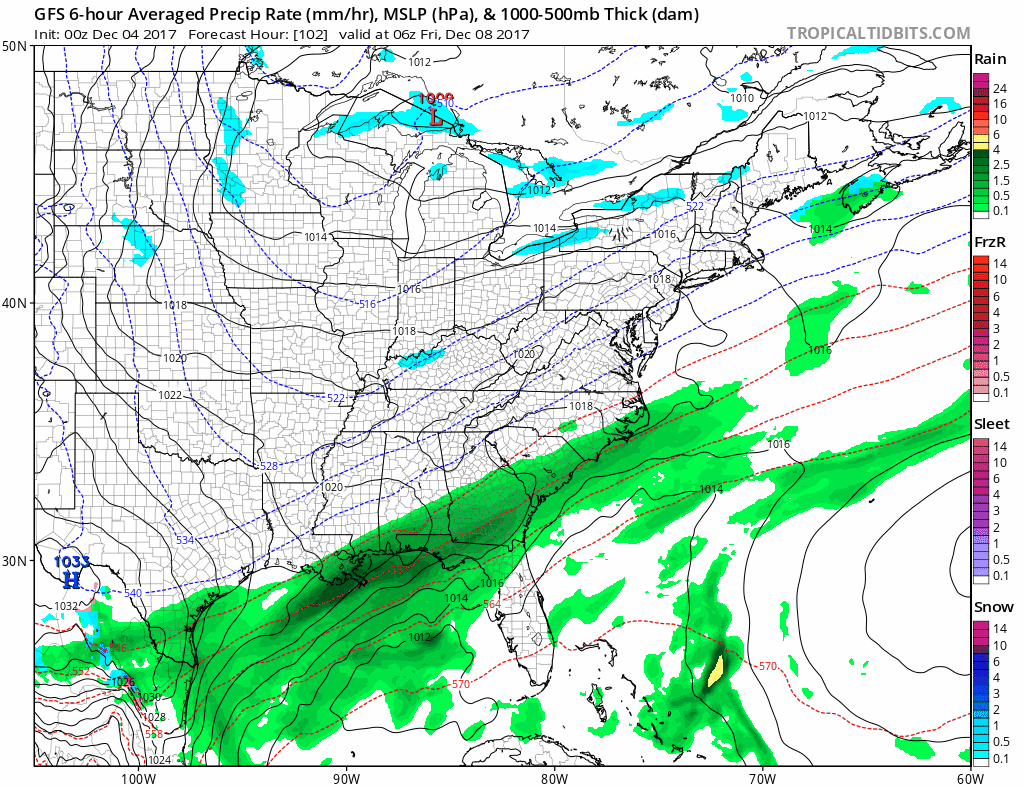 Snowfall accumulations from the same run... 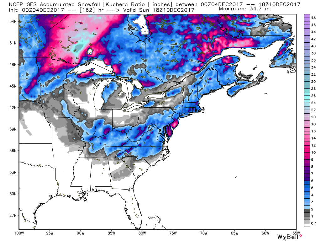 Verbatim, that would be at least a light snow maker for parts of the Ohio Valley and up the eastern coast Friday- Sunday. The European model has it more out to sea with a warmer look. It has a similar idea of the GFS of the placement, but snow totals are a lot lower...  It also indicates the clipper will be much less of a significance for the Ohio Valley. I will say the GFS has more of a reasonable look, for the clipper especially. The GFS has been very consistent of showing some harsh wintry weather over the next couple weeks across our part of the world. It's also pretty interesting to note the models are showing a coating of snow for even the SE. We will see if the Euro caves to the GFS within the next couple of days or vice versa. Let's watch for the EURO to correct itself similar to the GFS for the clipper in the Ohio Valley. Looking at the 500mb, that's impressive to see for the clipper later this week. 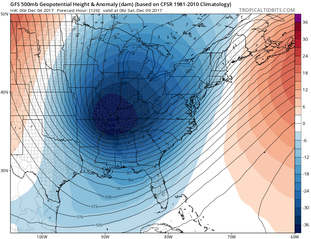 Looking down the road, the model guidance is suggesting several clippers to pass through as we head into next week. The GFS ensembles (mean) have not really budged with the 16 day snowfall totals... 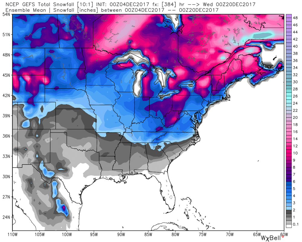 It sure looks like an interesting month ahead, snow lovers! We will take EACH system a case by case basis. As I've been harping about, the first system usually has an impact on the following system. Let me say this.... This month has a lot of potential, now let's sit back and see if it can produce.
We will keep an eye on the late-week setup. There's still A LOT of uncertainty with the possible east coast system and the clipper system. Again, I'm really liking the chance for the clipper impacting the Ohio Valley later this week. Now, we have to see what happens with the east coast system. Regardless, I'm liking the chance for at least some snow on the ground for the Ohio Valley, Mid Atlantic and Northeast before this week is over. I will be on limited time today but I will throw you guys another update this evening! Take care and have a great start to your work week. - Braden
|

 RSS Feed
